AERIAL IMAGING AND MAPPING: LEVERAGING RESOLUTION AND SPEED FOR AUTOMATION, MACHINE LEARNING, AND USER EXPERIENCE
Long gone are the days when maps were used solely for direction and aerial imaging used solely for visualization. Today, we rely on both maps and aerial imaging in our daily routines — providing real-time navigation across a variety of modes of transportation, verifying ground details without having to physically visit a location, and enabling real-world modeling of landscapes, cities, and planned developments and infrastructure. In addition to human interpretation of aerial imagery, high-resolution images are used to train machine learning algorithms and to support AI-based analysis.
Although manned aircraft have been used to facilitate image collection for decades, the advancement of unmanned aerial vehicles (UAVs) has resulted in accelerated market growth and technology adoption. Increased demand for detail, accuracy, and more intuitive user experiences has resulted in the adoption of higher camera resolutions and frame rates. The combination of these two factors has led to a greater volume of image data that also offers the benefit of increased pixel resolution and scene detail.
Additionally, increases in resolution and frame rate of aerial imaging and aerial mapping cameras enables image acquisition at higher altitudes and at increased relative ground speeds. The end result of these technological advances is an overall improvement in the quality of aerial imagery, increasing the potential for automated workflows, the use of machine learning, and a host of other industrial applications that rely on or can benefit from aerial imagery.
Applications
MORE THAN MAPS: INFRASTRUCTURE MONITORING TO EARTH OBSERVATION
The advantages of aerial imagery extend far beyond mapping and navigation. When equipped with the correct aerial imaging cameras, the data collection can be used for specific purposes across a variety of industries and applications. In defense, security and intelligence gathering, for instance, high-resolution images enable persistent monitoring of ground changes, helping to identify unexpected behaviors or movement of assets between key locations at critical installations and in remote areas that would otherwise be difficult to access.
Similarly, when it comes to critical infrastructure such as hydro-power dams, power plants, and pipelines, aerial imaging technology and aerial land survey capability contribute meaningful data that, when combined with ground condition data, offer a more complete picture of potential hazards and threats to operational stability; it also enables superior post-incident evaluation, improving organizations’ abilities to assess damage from natural disasters and other events quickly and reliably.

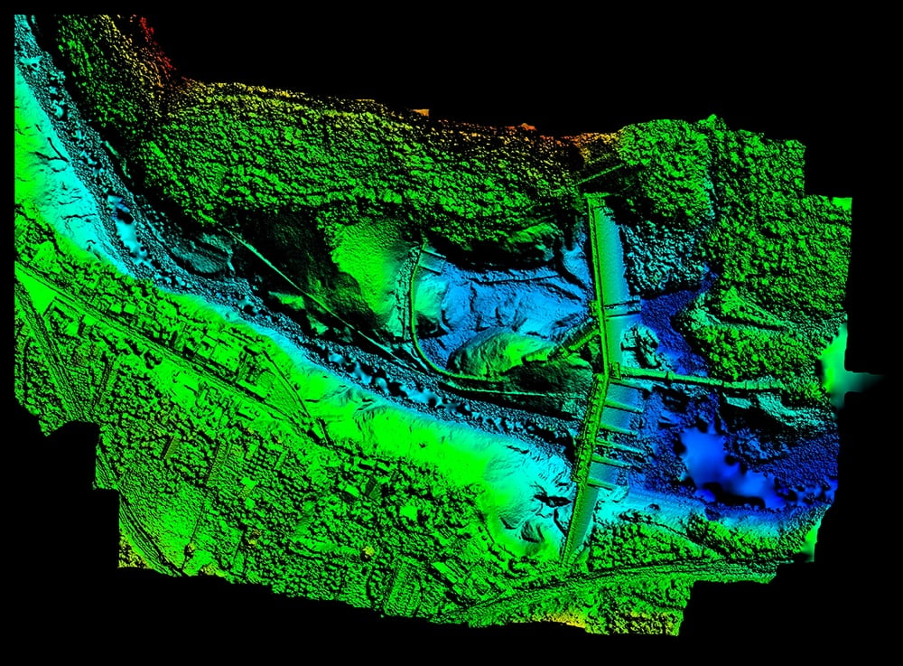
Fig 1: Drones equipped with high-speed Emergent GigE Vision cameras can capture high-resolution images for creating digital altitude models.
Changes in weather patterns have resulted in drought and heavy rainfall conditions in unexpected areas around the world. Aerial surveying enables earth observation across a vast area in a short amount of time to help measure the impact of changing weather patterns, and to prioritize response in the best interest of human safety and economic benefit.
Maximizing yields, water usage, and efficiency in agriculture has also become increasingly important as population growth and weather-pattern changes continue. Agricultural imaging aids in maximizing yield by providing farms with data useful for targeting hydration, pesticide use, and other inputs critical to optimal management of crop growth and harvesting.
RESOLUTION, SPEED, PERFORMANCE
Emergent Vision Technologies specializes in the design and development of industrial high-speed cameras providing some of the highest resolutions and frame rates available today, making them ideal for aerial mapping and aerial imaging across a diverse range of applications. Using established standards such as GigE Vision and GenICam, Emergent’s products integrate seamlessly into compliant software applications from third parties without the need for proprietary cabling or the acquisition of additional hardware.
With camera resolutions over 150MP, Emergent cameras offer ideal solutions for situations requiring both extremely high resolution and aerial surveying from increased altitude. With these high-resolution cameras, it becomes possible to increase the field of view, which results in a larger physical area being imaged in less time. And, the increased sensor resolution can achieve this without reducing pixel density in a defined geographic area.

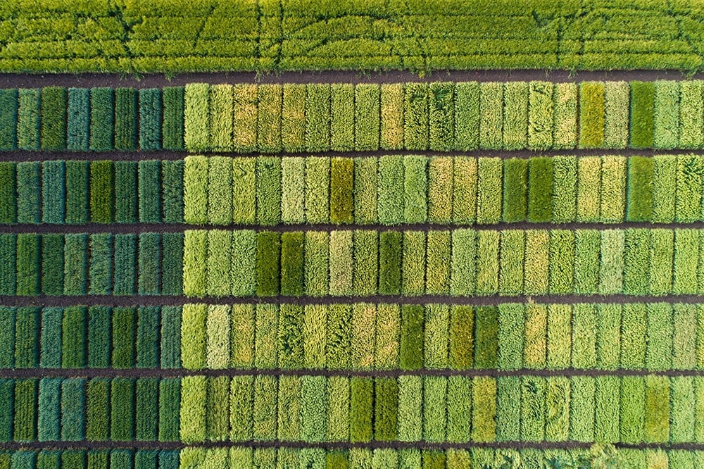
Fig 2: Aerial imaging systems leveraging Emergent high-speed cameras can aid farmers in agricultural test plot research for different crops.
For applications such as agricultural imaging or others where lower-altitude aerial imaging may be desired, increased frame rates help to prevent image smear and other negative effects. The increased frame rate on these cameras results in vast amounts of data being generated, which must then be transmitted quickly and reliably. Fortunately, Emergent’s use of Ethernet as their connectivity interface helps to solve these challenges also. With connectivity speeds of up to 100Gbps, maximum sensor frame rates are possible without sacrificing sensor resolution. This enables UAVs and manned aircraft to potentially fly faster, reducing imaging time and costs and maximizing use of resources.
PATTERN MATCHING
The below video shows how easily one can create and prototype an algorithm to perform high quality pattern matching while only writing your custom GPU Cuda code.
INFERENCE
The below video shows how easily one can add and test their own trained inference model to perform detection and classification of arbitrary objects. Simply train your model with PyTorch or TensorFlow and add this to your own eCapture Pro plug-in. Then instantiate the plug-in, connect to your desired camera and click run—it does not get easier than this.
With well trained models, inference applications can be developed and deployed with many Emergent cameras on a single PC with a couple of GPUs using Emergent’s GPU Direct functionality – nobody does performance applications like Emergent.

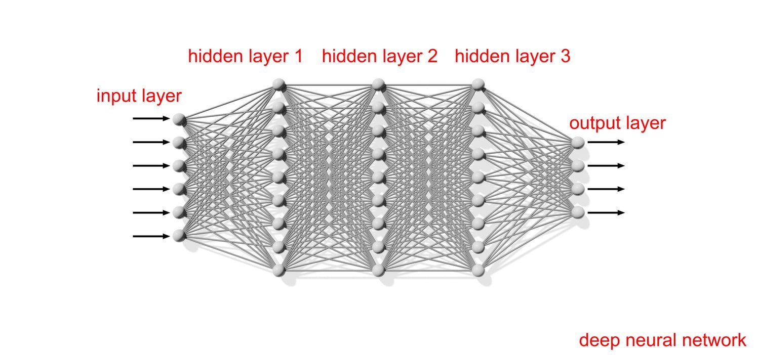
Fig 3: Modeled after the human brain, neural networks are a subset of machine learning at the heart of deep learning algorithms that allow a computer to learn to perform specific tasks based on training examples.
AUTOMATION RELIES ON RESOLUTION
Artificial intelligence, machine learning, and computer vision are used more and more often to perform image analysis, such as looking for changes in a scene over time, detecting the presence of something unexpected, or predicting future changes based on historical data. For computer-based systems to be effective, the images used to train the algorithms must be of sufficient quality. By increasing the pixel density — the number of pixels that cover a given area within an image — machine learning models can be better trained and subsequently can better perform their tasks.

As an added benefit, cameras such as those being made available by Emergent are fully compatible with data offload and GPU processing technologies such as NVIDIA’s GPUDirect, which enable the creation of an end-to-end image acquisition, transfer and processing solution for large amounts of sustained data. This enables data to be processed quickly and efficiently without worry about the loss of data packets or frames.

RIDING THE GROWTH CURVE
The demand for imaging technology to support the growth of industry and the expansion of use-cases for aerial imaging and aerial mapping cameras will continue to grow the overall market and, along with it, we should see continued increases in performance. Emergent’s cameras and acquisition solutions provide scalable and robust means of addressing the performance demand using ubiquitous cabling and connectivity, enabling system integrators and manufacturers to develop solutions today that can be repurposed easily to meet the needs of tomorrow.
EMERGENT GIGE VISION CAMERAS FOR AERIAL IMAGING AND MAPPING APPLICATIONS
| Model | Chroma | Resolution | Frame Rate | Interface | Sensor Name | Pixel Size | |
|---|---|---|---|---|---|---|---|
 |
HR-50000-M | Mono | 50MP | 23fps | 10GigE SFP+ | AMS CMV50000 | 4.6×4.6µm |
 |
HR-50000-C | Color | 50MP | 23fps | 10GigE SFP+ | AMS CMV50000 | 4.6×4.6µm |
 |
HB-127-SB-M | Mono | 127.7MP | 17fps | 25GigE SFP28 | Sony IMX661 | 3.45×3.45μm |
 |
HB-127-SB-C | Color | 127.7MP | 17fps | 25GigE SFP28 | Sony IMX661 | 3.45×3.45μm |
 |
HZ-100-G-M | Mono | 103.7MP | 24fps | 100GigE QSFP28 | Gpixel GMAX32103 | 3.2×3.2μm |
 |
HZ-100-G-C | Color | 103.7MP | 24fps | 100GigE QSFP28 | Gpixel GMAX32103 | 3.2×3.2μm |
 |
HZ-150-G-M | Mono | 152MP | 16fps | 100GigE QSFP28 | Gpixel GMAX32152 | 3.2×3.2μm |
 |
HZ-150-G-C | Color | 152MP | 16fps | 100GigE QSFP28 | Gpixel GMAX32152 | 3.2×3.2μm |
For additional camera options, check out our interactive system designer tool.


